
Lake Van
Lake Van is Turkey's largest lake, a vast alkaline soda lake with no outlet, set in the volcanic highlands of Eastern Anatolia at around 1,640 metres. Its unusual chemistry, depth and islands give it a character unlike any other lake in the country.
Lake Van (Van Gölü) is the largest lake in Turkey and among the biggest inland water bodies in the wider region. It lies in the eastern highlands of the country at an elevation of roughly 1,640 metres, stretching across the provinces of Van and Bitlis in Eastern Anatolia. It is a soda lake — an endorheic, strongly alkaline basin with no outlet to any sea. Its defining traits are its great size, its unusual water chemistry and the volcanic terrain that surrounds and shaped it.
Location and Setting
The lake occupies a large closed basin in the high plateau of eastern Anatolia, covering an area of about 3,700 square kilometres. Its shape is irregular and roughly triangular, with a broader eastern arm and a western section that narrows toward the town of Tatvan. The basin is rimmed by mountains and high ground on most sides, which gives the shoreline a mountain-lake setting rather than a lowland one.
The main settlement on the eastern shore is the city of Van, while Tatvan lies at the western end. Other towns along the edges include Ahlat, Adilcevaz, Erciş and Gevaş. The lake is deep for its setting: soundings reach around 450 metres at the deepest point, and the average depth is well over 100 metres. Because the surface sits so high and the basin is so deep, the lake holds an enormous volume of water.
A Soda Lake With No Outlet
Lake Van is endorheic, meaning no river carries water out of the basin. Several streams and rivers feed it, but the only way water leaves is through evaporation. As a result, dissolved minerals have accumulated over a very long period, and the water is both saline and highly alkaline, with a pH typically near 9.7. Sodium carbonate and sodium sulfate dominate the chemistry, which is why it is classed as a soda lake rather than a freshwater or ordinary salt lake.
This chemistry has practical consequences. The water is not drinkable and feels slippery or soapy to the touch. It also restricts which organisms can survive in it, making the lake far less biologically rich than a freshwater lake of similar size would be.
Volcanic Origins and the Nemrut Connection
The basin is tectonic in origin, part of the faulted and uplifted terrain of eastern Anatolia, and volcanism has played a central role in its history. West of the lake stands Mount Nemrut, a dormant volcano whose lava flows once blocked the basin's former outlet, helping to create the closed, ponded system seen today. The volcanic rocks and ash around the shores, together with the raised plateaus, are visible reminders of this history. Mount Nemrut itself holds a crater with its own small lake, a separate feature from Lake Van even though the two are closely linked geographically.
Islands and Shoreline
Several islands rise from the water, the best known being Akdamar, Adır, Çarpanak and Kuş Island. Akdamar lies near the southern shore close to Gevaş and is the most frequently visited. The islands are rocky and dry, standing out against the pale blue water.
The shoreline is varied. In places steep slopes and cliffs drop directly into the lake; elsewhere there are flatter stretches and rocky beaches formed from volcanic material. Where streams enter, reeds and marshy patches appear, and these wet margins contrast sharply with the bare, mineral-rich water beyond them.
Habitats and Wildlife
The alkaline water supports very few fish. The most notable is the pearl mullet, also called the Van fish, which is endemic to the lake and its feeders. Each spring it migrates up the inflowing streams to spawn in fresher water, an event tied to the seasonal rise of the rivers. Birdlife gathers around the islands and the mouths of the streams, where waterfowl and gulls use the wetlands and sheltered spots. Away from the water, the surrounding high ground is dry steppe and rocky slope, home to hardy plants adapted to cold winters and a short growing season.
The Lake Through the Seasons
The climate is continental and marked by cold, snowy winters and warm, dry summers, modified somewhat by the large body of water. Because the lake is saline, its freezing point is lower than that of fresh water, so open water usually stays unfrozen even in hard winters, while the shores can still be cold and icy. Spring brings snowmelt that swells the incoming streams, sets the pearl mullet running and greens the surrounding slopes briefly. Summer is the clearest and driest season, with strong sun and wide visibility across the basin. Autumn is milder, with calmer conditions before the cold returns. Afternoon winds are common in the warmer months.
Reaching and Exploring the Area
The lake is generally approached from the city of Van on the east or from Tatvan on the west, both served by road and connected to the wider region by rail and air links at Van. Roads run along much of the shoreline, so the lake can be seen from many points on a drive around the basin, and the changing profile of the water and mountains opens up repeatedly along the way. Boats cross to Akdamar from the southern shore near Gevaş. Because the basin is large, distances between the main towns are considerable.
Practical Natural Considerations
The high elevation means thinner air and cooler temperatures than at sea level, and weather can shift quickly, so warm layers are useful even in summer. The water is alkaline and should not be treated as drinking water. Sun exposure is strong at this altitude, and some stretches of shoreline are remote, with long gaps between settlements. Visitors should also note that the lake is a natural system under pressure from its closed basin and limited water exchange, and that its wildlife, especially the endemic fish, depends on the streams that feed it. Related natural features nearby include the volcanic highlands and crater of Mount Nemrut to the west and the surrounding mountains of the eastern Anatolian plateau.
Beaches & bays
See the coast →
Related content
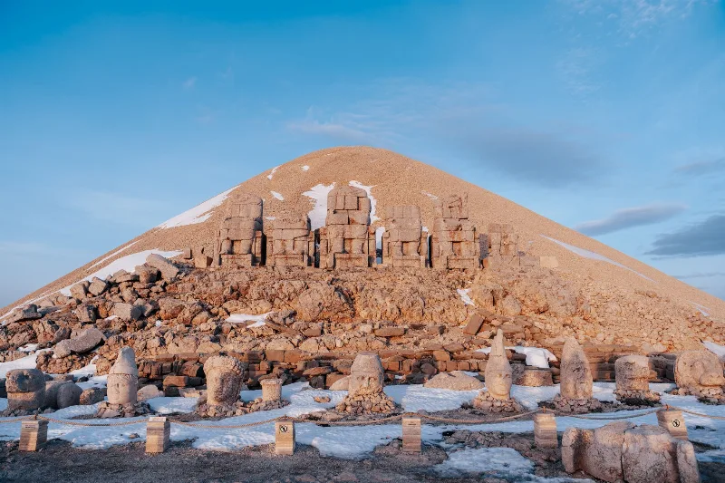
Nemrut
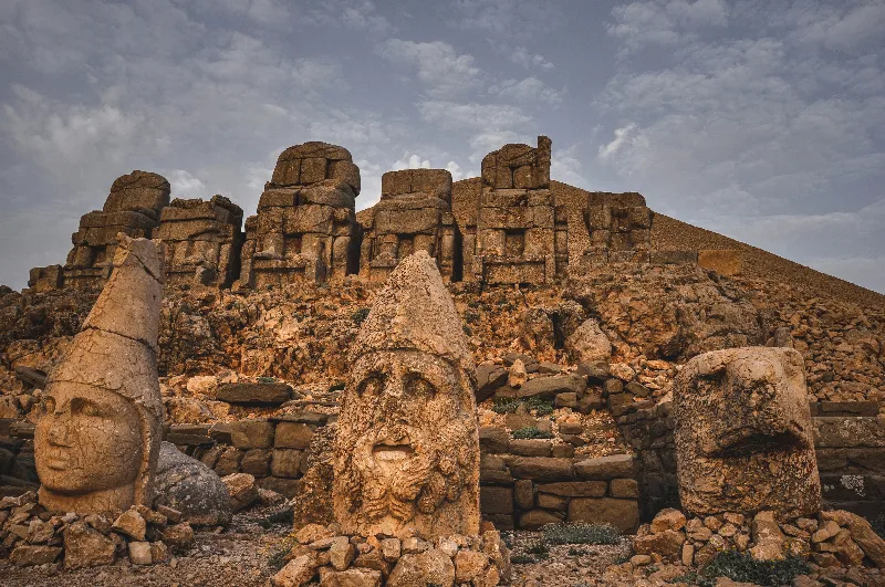
Mount Nemrut in Adıyaman Province is a 2,134-metre summit crowned by the colossal statues and tomb-sanctuary built by King Antiochus I of Commagene, and it has been a UNESCO World Heritage Site since 1987.
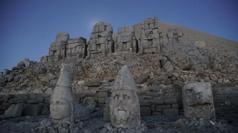
Mount Nemrut
Mount Nemrut in Adıyaman Province is the summit hierothesion of King Antiochus I of Commagene, where colossal statues of gods and a royal ruler stand on terraces above an artificial stone tumulus. The site is a UNESCO World Heritage property whose Greek inscriptions and reliefs record a Hellenistic kingdom of the first century BC.
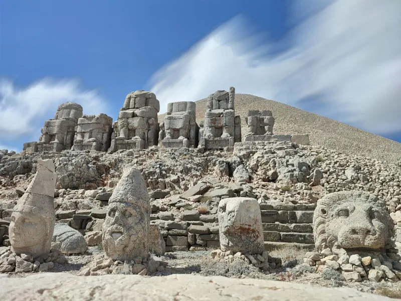
Mount Nemrut
Mount Nemrut is a dormant volcano in Bitlis Province, eastern Türkiye, featuring a large caldera with crater lakes. It lies west of Lake Van near Tatvan.
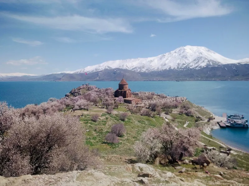
Lake Van
Lake Van is Turkey's largest lake and the world's largest soda lake, located in Eastern Anatolia. It is known for Akdamar Island and its 10th-century Armenian Church of the Holy Cross.
The Fascinating History of Mount Nemrut
Mount Nemrut is renowned for its ancient statues and monumental tombs, offering a glimpse into a mysterious past.
Adıyaman
Explore Adıyaman, southeastern Türkiye: history, standout sights, landscapes, local food and practical travel advice for an unforgettable journey in Türkiye.