
2-Day Rize and Ayder Route
A two-day linear route from Rize city through the coastal tea gardens and the Fırtına Valley to the Ayder Plateau in the Kaçkar Mountains.
This two-day route begins in the city of Rize on Türkiye's eastern Black Sea coast and ends at the Ayder Plateau in the Çamlıhemşin district, high in the Kaçkar Mountains. Over two days it links the coastal tea gardens around Rize, the inland Fırtına (Storm) Valley and its historic stone bridges, and the cool alpine meadows and hot springs of Ayder. The journey is linear rather than circular, follows a single corridor inland from the coast, and is best done by car with short walks at each stop. The daily distances are modest, but the mountain road is winding, so the pace is relaxed rather than rushed.
The route suits travellers who want to understand how the Black Sea coast, the tea-growing hills immediately behind it, and the high Kaçkar plateau fit together as one continuous landscape. Rize provides urban and cultural context, the valley adds history and village life, and Ayder delivers mountain scenery and geothermal springs.
Day 1: Rize, the Coastal Tea Gardens and the Road to Çamlıhemşin
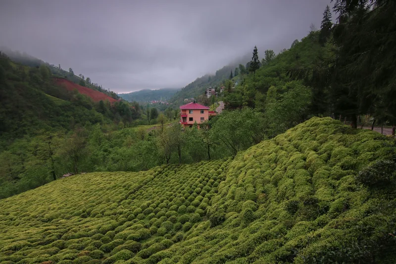
The day starts in Rize itself. The city is the centre of Turkish tea production, and the hillsides above it are covered with terraced tea gardens that are as much a working landscape as a scenic one. A morning in Rize works best by combining the town with the gardens: walk through the tea slopes close to the city, then visit Rize Castle, a compact historic site on a hill above the centre that gives a clear view over the coast and the green hills behind it. This is the right place to see how the humid Black Sea climate shapes everything that follows, from the constant greenery to the mist and dense vegetation.
From Rize the route follows the coast eastward, passing through the tea-processing districts of the coastal strip. The point of this first stretch is orientation rather than sightseeing: the sea stays on one side while the tea hills rise on the other, and the shift from coastal town to mountain district becomes obvious.
At Ardeşen the route turns inland and climbs into the Fırtına Valley, the gateway to Çamlıhemşin. The character of the landscape changes quickly: the road narrows, follows a fast mountain river, and passes some of the region's best-known historic stone arch bridges, built in the Ottoman period and still standing in the valley. There is no need to stop at every one of them; the bridges are part of the route's identity and can be appreciated as you move up the valley. Overnight is in Çamlıhemşin or in the lower part of the valley, which puts you in position for the next day.
Day 2: Şenyuva, Zilkale and the Ayder Plateau
Day two continues from Çamlıhemşin deeper into the same valley system. A short detour leads to the village of Şenyuva and on to Zilkale, a medieval castle set on a rocky outcrop above a forested gorge. The castle is the historic counterpoint to the tea gardens of the previous day, and the walk up to it gives a sense of how isolated these valleys once were. The detour fits naturally into the morning because it branches off the main valley road and returns the same way.
From there the route climbs to the Ayder Plateau, the endpoint of the journey and the highest point of the trip. Ayder sits in alpine meadow country below the Kaçkar range, and its main draws are the hot springs, the waterfalls in the surrounding green ravines, and the open mountain views. Time here is best spent on foot: walk the plateau paths, follow the water, and use the hot springs to recover from the drive. Facilities are concentrated in the plateau village, so the atmosphere is calm compared with the coast.
Ayder is also where the route ends. Travellers who want to continue into the Kaçkar Mountains can do so on foot or by continuing higher on the plateau roads, but the two-day route itself finishes here.
When to Go and How to Plan Around the Route
The best season runs from late spring to early autumn. Summer is the most reliable period for the plateau, when the high meadows are open and the mountain roads are easiest. Spring brings heavy rain and mist to the Black Sea coast, which is part of the region's character but can hide the views. Winter snow restricts access to the higher ground around Ayder, so the plateau section is not a year-round option.
Because the route is linear and follows a single valley inland, a car is the practical way to travel; public transport reaches the towns, but the valley and plateau stops are easier with your own vehicle. The Fırtına Valley road is winding and can be slow, so it is worth treating the driving as part of the experience rather than something to rush. Comfortable shoes matter for both the castle walk and the plateau paths.
Read together, the two days move from sea level to high mountain, from tea terraces to historic bridges and a medieval castle, and end among hot springs and alpine meadows, a compact but complete introduction to the Rize and Ayder corner of the eastern Black Sea region.
Remarkable Places
See all places →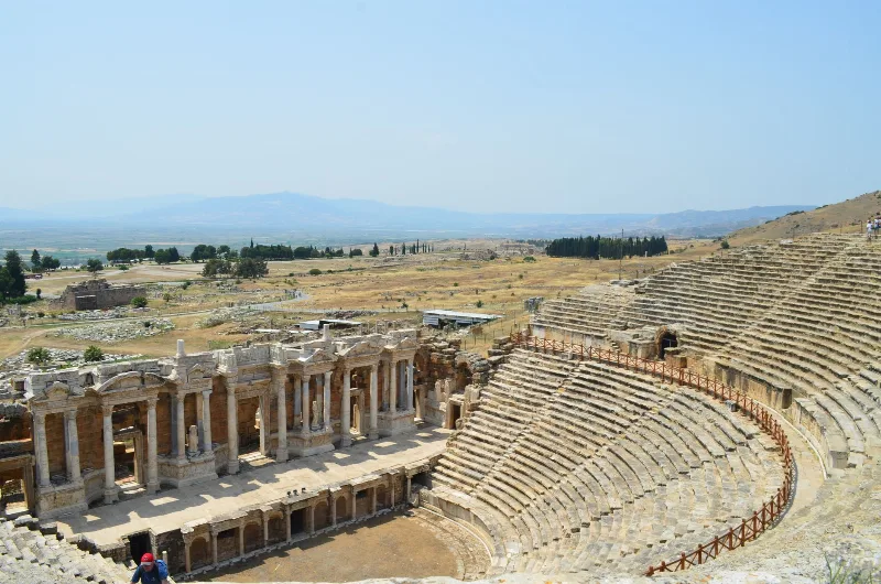
Letoon
Letoon is a Lycian sanctuary near Xanthos in Muğla Province, dedicated to Leto, Artemis and Apollo. Its three temples, theatre and trilingual inscription make it one of southwestern Turkey’s most significant archaeological sites.
Explore →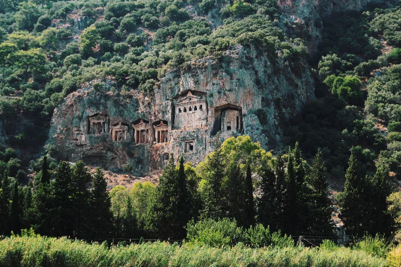
Kaunos
Kaunos is an ancient Carian city on the Dalyan River in Muğla Province, known for its temple-style rock-cut tombs and the extensive ruins of a harbour that silted up centuries ago.
Explore →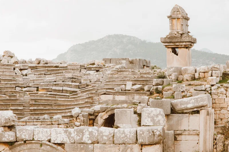
Xanthos
Xanthos is an ancient Lycian city in Antalya Province and a UNESCO World Heritage Site, known for its Lycian tombs, Roman theatre and role as a leading city of Lycia.
Explore →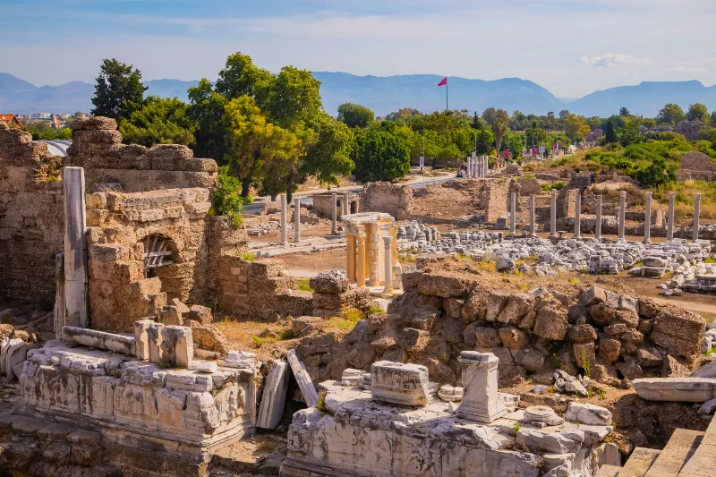
Phaselis
Phaselis is a Rhodian-founded port city on the eastern Lycian coast, where paved streets, agoras, baths and a small theatre stand among pines between three sheltered bays.
Explore →Related content
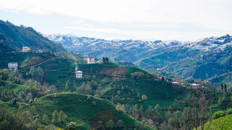
Rize
Rize is the capital of Rize Province on Türkiye's northeastern Black Sea coast, a city shaped by tea plantations, steep forested slopes and the high plateaus of the Kaçkar Mountains further inland.
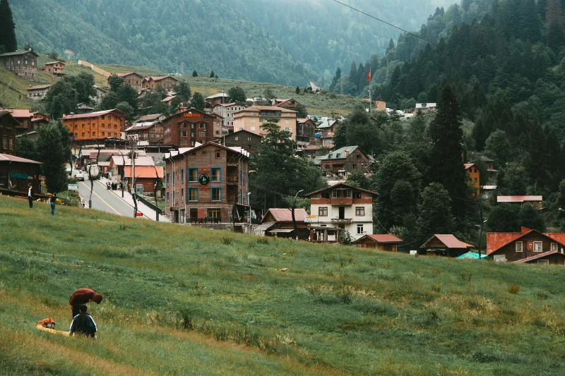
Ayder
Ayder is a highland village in the Çamlıhemşin district of Rize, set in the Kaçkar Mountains and known above all for its thermal springs, timber architecture and waterfalls.
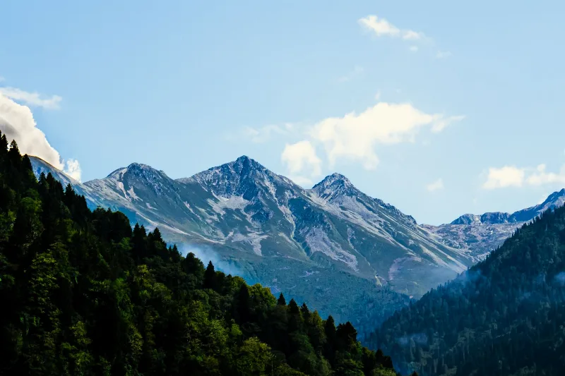
Kaçkar Mountains
The Kaçkar Mountains form the highest section of Turkey's Black Sea ranges, a glacially sculpted landscape of sharp summits, cirque lakes and high summer pastures.
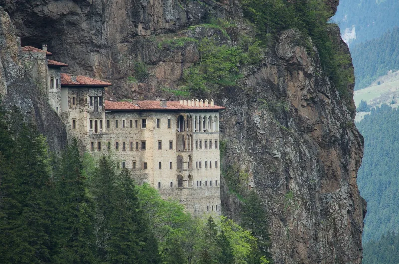
7-Day Eastern Black Sea Highlands Route: Trabzon to Artvin
A seven-day driving route through the Eastern Black Sea highlands, from Trabzon and Sumela to Uzungöl, Ayder, the Kaçkar Mountains and the forests of Şavşat, ending at Artvin.
Rize and the Tea Plantations
Rize, on Türkiye's eastern Black Sea coast, is a green province of terraced tea gardens, misty hills and mountain valleys shaped by rain and local tradition.
5-Day Eastern Black Sea Route
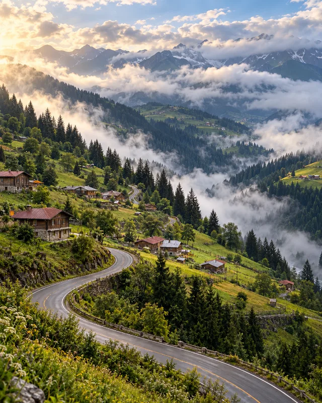
A five-day journey from Trabzon through Uzungöl, Rize, Çamlıhemşin, Ayder, Borçka and Şavşat, combining Black Sea culture with forests, lakes and highlands.