
Mount Ararat
Mount Ararat (Ağrı Dağı) is a dormant, snow-capped stratovolcano in eastern Turkey and the country's highest mountain, rising in two distinct cones above the Iğdır Plain near the Iranian border.
Mount Ararat, known in Turkish as Ağrı Dağı, is a dormant stratovolcano in eastern Turkey and the highest mountain in the country. It rises from a broad plain near the borders with Iran and the Nakhchivan exclave of Azerbaijan, in the wider region of the Armenian Highlands. The massif is made up of two separate volcanic cones — the main, ice-covered summit and a smaller companion peak — and its upper slopes carry permanent snowfields and glaciers that persist through summer.
Where Mount Ararat Stands
The mountain lies in the far east of Anatolia, close to the corner where the Turkish frontier meets Iran and the Nakhchivan exclave of Azerbaijan. Administratively the summit falls within Iğdır Province, while the town of Doğubayazıt in Ağrı Province sits on the opposite, western side of the massif. The peak rises sharply from the flat Iğdır Plain, part of the Aras River valley, which means its full height is visible from the surrounding lowlands and it dominates the horizon across a wide area. There is no gradual build-up of foothills; the volcano stands almost alone against the plain, which is a large part of what makes the setting distinctive.
Two Summits and a Volcanic Structure
Ararat is not a single cone but a paired volcanic system. The main summit, Greater Ararat (Büyük Ağrı), reaches about 5,137 metres and is the higher of the two by a wide margin. To the southeast, separated by a high saddle and a broad lava plateau, rises Little Ararat (Küçük Ağrı) at roughly 3,896 metres. Both are the product of layered eruptions, in which flows of lava and accumulations of ash and volcanic debris built up in alternating bands — the structure typical of a stratovolcano. The rocks are largely andesitic and basaltic in composition, and the shape of the massif reflects a long history of volcanic activity during the geologically recent past. Activity is considered dormant rather than extinct; the most destructive recorded event was a large earthquake and associated debris flow in the mid-nineteenth century that affected settlements on the northern slopes.
Ice, Snow and the High Terrain
The permanent ice cap near the summit is one of the most defining features of the mountain. Snow and glacial ice cover the highest ground year-round, and meltwater from these upper snowfields feeds streams that run down toward the plain. Where snow retreats in late summer, the surface is exposed as loose scree and bare volcanic rock, with steep gullies and abrupt drops that make the upper slopes demanding terrain. The transition between the lower, gentler skirts of the volcano and the steep summit zone is fairly abrupt, especially on the eastern and southeastern flanks.
How the Landscape Changes Through the Seasons
The climate of the area is continental, with strong contrast between the lowland plain and the summit. Summers on the plain are hot and dry, but temperatures fall sharply with altitude, and even in the warm months the high slopes remain cold and wind-affected. Winter brings heavy snowfall and deep cold, and the snow line descends far down the mountain, so the whole massif appears white. In spring, melting snow swells the streams that drain the slopes and the surrounding plain becomes green, while the upper snowfields begin to recede. By late summer the snow has withdrawn to the highest elevations, leaving the mid-slopes bare and stony. Autumn tends to be clear but increasingly cold, and snow begins to return to the higher ground.
Vegetation, Habitat and Wildlife
Because the mountain rises directly out of a dry plain, the vegetation changes quickly with height. The lower ground around the base is steppe and dry grassland, with poplar and willow along the watercourses of the plain. Further up, the slopes shift toward alpine meadow grasses and low cushion plants, thinning out as altitude increases until only rock, scree and ice remain near the top. The high, open terrain of the eastern Anatolian uplands supports wildlife adapted to cold, exposed conditions, and the broader area around the massif is part of a large, sparsely populated natural region. Specific sighting of animals should not be expected; the environment is rugged and the animals that live there are shy and scattered.
Reaching the Mountain and Its Setting
The general area is reached by road through eastern Turkey, with Doğubayazıt on the western side and the town of Iğdır on the northern side serving as the main hubs near the massif. The nearest airports are in Iğdır and, further southwest, Van. The mountain itself is not a roadside attraction: the lower slopes can be seen from the plain and from the roads that skirt it, but movement onto the higher mountain is regulated, and access above a certain point requires official permission and is normally undertaken with proper preparation. The land immediately around the base is open, dry and wind-exposed, so even viewing the mountain at close range calls for suitable clothing and awareness of the weather.
Practical Natural Conditions Before Visiting
The combination of high altitude, cold, wind and rapid weather changes makes the upper mountain serious terrain. Snowfields and glaciers remain on the summit even in summer, and the loose volcanic scree on the slopes offers uncertain footing. There are no natural shelters on the exposed upper ground, and conditions can shift quickly from clear to clouded and windy. Anyone planning to approach the higher part of the mountain must be prepared for low temperatures and for the altitude itself, which affects people long before the summit is reached. The lower plain, by contrast, is hot and dry in summer, so the variation between base and summit is extreme.
Nearby Natural Features
The Aras River valley and the flat Iğdır Plain that surround the volcano form a natural setting of their own, contrasting the dry, open lowland with the ice-capped peak above it. Little Ararat stands as a distinct secondary volcanic cone to the southeast of the main summit. Further afield, the broader eastern Anatolian region contains other upland and volcanic landscapes, and Lake Van lies well to the southwest, though at a considerable distance. Taken together, Mount Ararat is defined less by forests or greenery than by the stark contrast between a bare, level plain and a two-peaked volcano whose summit carries permanent ice.
Beaches & bays
See the coast →
Related content
Ağrı
Explore Ağrı, eastern Türkiye: history, standout sights, landscapes, local food and practical travel advice for an unforgettable journey in Türkiye.
Lake Van
Lake Van is Turkey's largest lake, a vast alkaline soda lake with no outlet, set in the volcanic highlands of Eastern Anatolia at around 1,640 metres. Its unusual chemistry, depth and islands give it a character unlike any other lake in the country.
Lake Van
Lake Van is Turkey's largest lake and the world's largest soda lake, located in Eastern Anatolia. It is known for Akdamar Island and its 10th-century Armenian Church of the Holy Cross.
Eastern Anatolia Region
Eastern Anatolia is a region of majestic mountains, vast highlands, beautiful lakes and ancient cultural heritage. Home to Mount Ararat, Lake Van and historic settlements, it offers some of Türkiye's most dramatic natural landscapes alongside distinctive architecture, local traditions and regional cuisine.
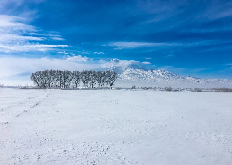
Mount Ararat
Mount Ararat is a dormant stratovolcano in eastern Türkiye and the country's highest mountain at 5,137 metres, known for its twin peaks, permanent ice cap and the long-standing Noah's Ark tradition.
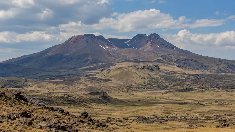
Mount Tendürek
Mount Tendürek is a broad shield volcano in eastern Turkey, close to the Iranian border, whose summit caldera contains two craters, a small lake and active fumaroles. Its bare lava slopes rise above the high pastures between the Ağrı and Van provinces.