
Hattusa: The Hittite Capital at Boğazkale, Çorum
Hattusa was the seat of the Hittite Empire in the Late Bronze Age and is now a UNESCO World Heritage Site in Çorum Province, Türkiye. Its walls, temples, gates and the nearby rock sanctuary of Yazılıkaya make it one of the most important archaeological landscapes in the ancient Near East.
Hattusa, also written Hattuša, was the capital of the Hittite Empire in the Late Bronze Age and is today one of the largest archaeological sites in Anatolia. It lies immediately south of the small town of Boğazkale in Çorum Province, in the Central Anatolian region of Türkiye, roughly 200 kilometres east of Ankara. The Hittites controlled much of Anatolia and, at their peak, extended their authority into northern Syria and the Levant between roughly the 17th and the 12th centuries BCE, and Hattusa was the seat of their kings. The city was inscribed on the UNESCO World Heritage List in 1986 together with the nearby rock sanctuary of Yazılıkaya, in recognition of its role in the political and cultural history of the ancient Near East and of the urban and architectural remains preserved there.
The setting on the Anatolian plateau
Hattusa occupies a folded, rocky pocket of the Central Anatolian plateau at roughly 1,000 metres above sea level. The site is not built on a single flat mound but spread across a sloping terrain of hills, ridges and shallow valleys, with the settlement filling the bowl between them. A small stream runs through the lower ground, providing the water supply that made a large permanent capital possible. The outer walls of the city enclosed an area of around 180 hectares, and the circuit of fortifications ran for several kilometres over the surrounding ridges, following the natural contours of the land rather than a simple geometric plan.
This landscape matters for understanding the site. The Hittites used high ground for defence and for the citadel, the gentler slopes for temples and administrative buildings, and the valley floor for the main temple complex. The rocky outcrops around the city also provided the stone used in construction, and the same geology appears again at Yazılıkaya, where the sanctuary was carved directly into natural limestone.
Why Hattusa matters in ancient history
For several centuries Hattusa was one of the major capitals of the ancient world, comparable in political weight to the centres of Egypt, Assyria and Babylon. From here the Hittite kings governed an empire that negotiated and fought with Egypt, and the city was the administrative, religious and diplomatic heart of that state. Its archives produced tens of thousands of cuneiform clay tablets, making Hattusa one of the richest documentary sources for the Late Bronze Age. The city was abandoned after the collapse of the Hittite Empire around the beginning of the 12th century BCE, a period of widespread disruption across the eastern Mediterranean. Later, a smaller settlement of a different culture occupied part of the site, but the Hittite capital was never rebuilt on the same scale, which is one reason its remains survived in recognisable form.
The lower city and the Great Temple
The lower city spreads across the gentler ground in the northern part of the site. Its focal point is the Great Temple, a large rectangular complex built of stone foundations with a paved courtyard. The temple was dedicated to the Storm God and the Sun Goddess, the principal deities of the Hittite state, and it is the most substantial religious building known from the Hittite world. Around the temple lie the remains of other structures, workshops and storage buildings, and the outlines of streets can still be traced in the ground. Visitors walking the lower city see mostly foundation walls and reconstructed sections rather than standing buildings, and it helps to picture the original structures as timber-framed and mud-brick above a stone base.
Büyükkale, the royal citadel
Büyükkale is a rocky hill in the eastern part of the site that served as the royal citadel, the fortified core where the king's palace and the main administrative buildings stood. The approach is steep, and the layout is compact and defensive, with a series of courtyards and terraced levels. From the top there is a wide view over the lower city and the surrounding valley, which makes the logic of the site's geography easy to read. The palace complex here is where much of the state's record-keeping was concentrated, and finds from these buildings contributed heavily to the tablet archive.
The upper city, Yerkapı and the monumental gates
The southern part of Hattusa, known as the upper city, is a broad elevated area containing a large number of temples, some of them small and tightly grouped. Its most striking feature is Yerkapı, an enormous artificial embankment built along the line of the southern defences. Inside the embankment runs a long, sloping stone tunnel, a postern passage that allowed movement through the wall without using a gate. The scale of the earthwork is remarkable, and walking through the tunnel is one of the more memorable experiences at the site.
Hattusa is best known for its gates, several of which carried large carved figures. The Lion Gate, on the south-western stretch of the walls, is flanked by two lions carved in relief, and it is the image most often associated with the city. The King's Gate, on the south-eastern side, features a relief of a warrior figure. A third gate, the Sphinx Gate at Yerkapı, was decorated with large sphinx sculptures. The originals of the most important reliefs and sculptures have been moved to museums for protection, and replicas stand in their place at the site.
The walls and defences
The fortifications of Hattusa are among the most studied in the ancient Near East. The walls combined a rubble and stone base with a mud-brick superstructure and were reinforced by towers and bastions at intervals. On the higher ridges the line followed the rock, and in the lower ground it was strengthened by massive embankments. Reconstructed sections of the wall give a sense of the original height and massing, while the excavated stretches show the construction techniques and the gates in plan. Together with the citadel and the layout of the upper city, the defences show a capital designed as a defended royal and religious centre rather than an ordinary settlement.
The cuneiform archives
The clay tablets recovered at Hattusa are one of the site's greatest contributions to history. They include treaties, royal correspondence, laws, religious texts, ritual instructions, chronicles and administrative records, written in cuneiform script. Among the most famous documents is a peace treaty between the Hittites and Egypt, whose Hittite version was preserved in the archives. These tablets allow historians to reconstruct the political relationships, legal practice and religious life of the Hittite state in unusual detail. Because of this, the tablet archive has been recognised as a documentary heritage of global importance, and significant collections from the site are displayed in Turkish museums, notably in Ankara and Istanbul.
Yazılıkaya, the rock sanctuary next door
About two kilometres from the city, Yazılıkaya is an open-air sanctuary carved into natural limestone outcrops. It consists of two chambers, generally called Chamber A and Chamber B, whose walls are covered with relief carvings of Hittite deities in procession. The larger chamber shows male and female gods arranged in ordered rows, a rare visual record of the Hittite pantheon, while the smaller chamber carries a different set of figures. The sanctuary appears to have been used for cult ceremonies connected with the royal house rather than for everyday worship, and its reliefs are among the clearest surviving expressions of Hittite religious imagery. The site is part of the same UNESCO inscription as Hattusa and is usually visited on the same trip.
What you actually see on the ground
Hattusa is an excavated ruin rather than a reconstructed ancient city. Visitors should expect stone foundations, stretches of wall, gate structures and open ground, with interpretation panels and reconstructed elements helping to explain the layout. The reliefs at the gates are largely replicas, so the original carvings need to be seen in the regional museums. The terrain is uneven, with slopes and gravel paths, and the site is large enough that covering the main areas takes several hours on foot. The atmosphere comes from the scale of the landscape and the extent of the remains rather than from standing monuments.
Getting there and moving around
The site is reached by road, with Boğazkale as the base. Most visitors arrive by car or on an organised day trip from Ankara or Çorum, and the drive from Ankara takes roughly three hours. There is no railway station or airport at the site itself. Within the site, the different sectors are connected by walking routes; a vehicle is useful for reaching Yazılıkaya and for moving between the entrances if you do not want to walk everything. The small museum in Boğazkale town displays finds from the excavations and is a sensible first or last stop to understand what you are seeing. Visitors should note that some facilities and opening arrangements vary through the year.
When to visit
Central Anatolia has a continental climate, with hot, dry summers and cold winters that can bring snow. Spring and early autumn are generally the most comfortable periods for walking the site, with moderate temperatures and reasonable light for reading the landscape. Midsummer can be very hot, and there is little shade across much of the open ground, so early mornings are preferable in that season. Winter visits are possible but the site can be cold and exposed, and snow occasionally affects access to higher parts of the ruins. Daylight hours are also shorter outside the summer months, which matters given how much ground there is to cover.
Practical points before you go
- Wear sturdy footwear: the paths are gravel and uneven, with slopes between the lower and upper city.
- Bring water, sun protection and a hat, as shade is limited and the site is large.
- Allow at least half a day for Hattusa itself, plus time for Yazılıkaya and the museum in Boğazkale.
- Remember that the most famous reliefs at the gates are replicas; the originals are in museums elsewhere.
- Interpretation is mostly in the form of panels on site, so reading up beforehand makes the ruins far easier to understand.
Related places in the area
Alacahöyük, another significant Hittite site with its own decorated gate, lies a short drive from Boğazkale in Çorum Province and is often combined with a visit to Hattusa. The city of Çorum has a museum with regional archaeological collections, and Ankara's major archaeological museum holds extensive Hittite material from the region. Travellers crossing Central Anatolia can connect Hattusa with the wider historical landscape of the plateau, including the nearby provincial centres and other excavated sites that together trace the history of Anatolia before and after the Hittite period.
Related content
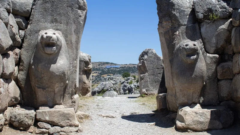
Hattusa
Hattusa was the capital of the Hittite Empire, located near Boğazkale in Çorum Province. Its surviving walls, gates, temples and cuneiform archives make it one of the most important Bronze Age archaeological sites in Anatolia.
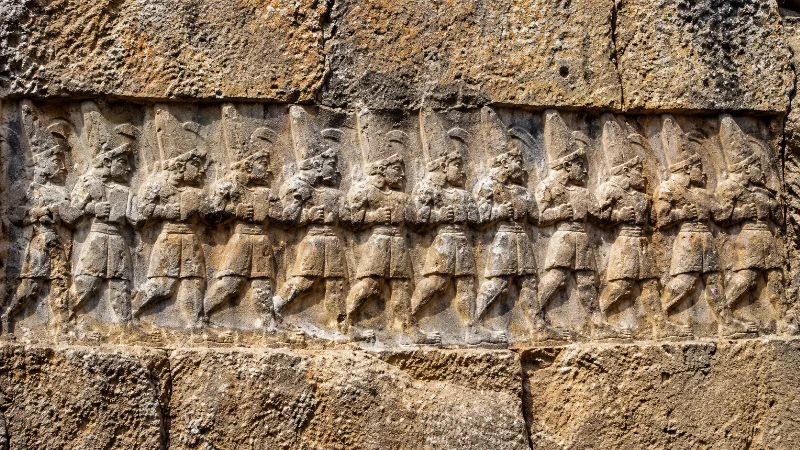
Yazılıkaya
Yazılıkaya is an open-air Hittite rock sanctuary cut into limestone near the ancient capital of Hattusa, decorated with reliefs of gods and kings and now part of a UNESCO World Heritage Site.
Ankara
Ankara is the capital of Türkiye and the country's second-largest city, set on the high plateau of Central Anatolia and defined by its republican institutions, its long pre-Ottoman history and the mausoleum of Mustafa Kemal Atatürk.
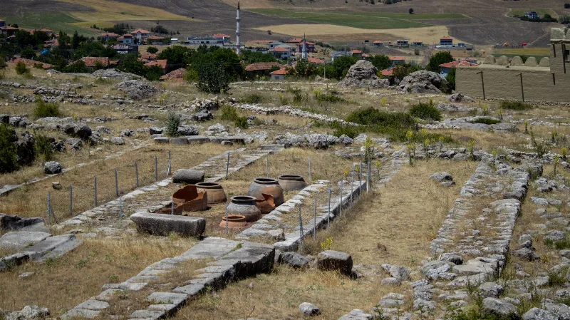
The Ancient Hittite Capital of Hattusa
Hattusa, the Hittite capital in Çorum, preserves monumental gates, temples and royal buildings from one of the ancient Near East's great powers.
Alacahöyük: A Hittite City and Early Bronze Age Royal Tombs in Çorum
Alacahöyük is an excavated mound in Çorum Province that holds both Early Bronze Age royal tombs and a monumental Hittite gate flanked by carved sphinxes. It is one of the key sites for reading the pre-Hittite and Hittite past of central Anatolia.
Alacahöyük
In Çorum Province, Alacahöyük preserves a long settlement sequence, elite Early Bronze Age burials and a monumental Hittite gate with carved reliefs.